New ocean wind speed and direction database available on the AODN Portal

The IMOS Surface Waves sub-Facility, which is operated by CSIRO in partnership with University of Melbourne, have just published a new wind data collection in the AODN Portal.

The new collection is a km-resolution ocean wind speed and direction database over coastal seas of Australia, New Zealand, Western Pacific islands, and the Maritime continent. It is obtained from Europe’s Copernicus Sentinel-1 A and B Synthetic Aperture Radar (SAR) satellites from 2017 up till present.

A SAR is a microwave radar sensor used to measure the reflection or scattering effect produced while imaging the surface of the earth in high resolution from an aircraft or a satellite. It can record measurements even at night, during cloud cover, and in most weather conditions.

Wind measurements by SAR go all the way up to the coast due to its high resolution, filling critical gaps in ocean wind speed and direction observations in coastal areas.

SAR ocean wind measurements are calibrated and validated against overlaps with offshore Scatterometer and Altimeter wind measurements. Both Scatterometer and Altimeter Ocean winds are already carefully calibrated against ocean buoys.

The new collection is a first of its kind in the region and captures the spatial variability of coastal ocean winds over a wide swath (250 km). SAR measurements over strong wind events, including tropical cyclones, reveals new insights into the structure of extreme wind fields.

These data are useful for offshore industry (oil and gas, fisheries, shipping, offshore wind), protection and management of coasts, habitats, and infrastructure, capturing of sub-mesoscale air-sea interactions, and improvement of forcing in numerical models.

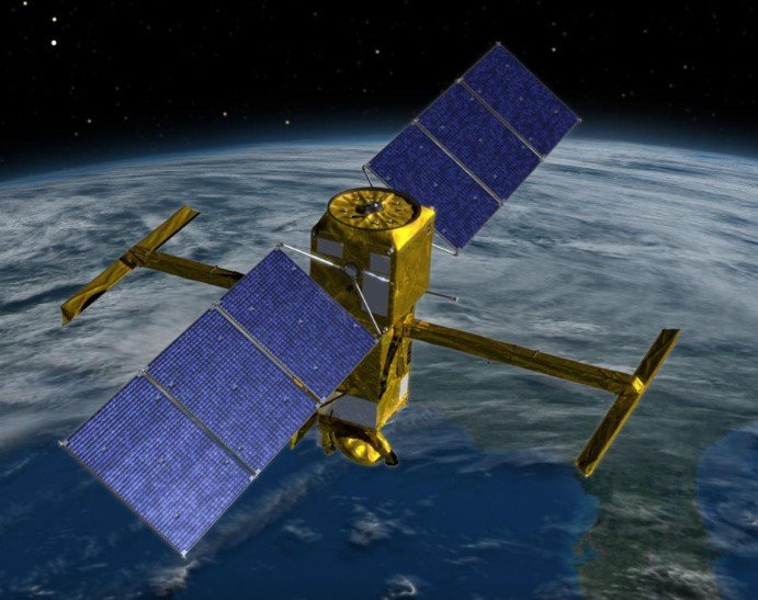
Lift-off! SWOT launches a new era of satellite oceanography

NASA-CNES SWOT (Surface Water and Ocean Topography) is Go!

After decades of planning and preparations, SWOT took off aboard a SpaceX Falcon 9 rocket from Vandenberg Space Force Base on a cold clear morning on 16 December 2022.

After a checkout of the satellite's health and functional behaviour, the operations team then proceeded to deploy the KaRIn interferometric radar antennas. This process, which occurs over four days, involved unfolding the mast, then moving the mast into flight position and then unfolding the antenna’s at the tip of each mast. You can watch an animation of the deployment here.

Over the coming months, the operations team will adjust the orientation of the satellite and commence payload turn-on in advance of the calibration and validation and fast-sampling phases of the mission. The nominal fast-sampling phase is now scheduled for April-June 2023 with the first "pre-validated" SWOT data anticipated to become available late September or early October.

The SWOT mission brings together two communities focused on a better understanding of the world's oceans and its terrestrial surface waters. U.S. and French oceanographers and hydrologists and international partners have joined forces to develop this satellite mission to make the first global survey of Earth's surface water, observe the fine details of the ocean's surface topography, and measure how water bodies change over time.

SWOT is being jointly developed by NASA and Centre National D'Etudes Spatiales (CNES) with contributions from the Canadian Space Agency (CSA) and United Kingdom Space Agency.

In addition, the SWOT mission was featured in the most recent issue of Australia in Space magazine (pages 40 to 42).

MODIS Terra scheduled to exit the 'Morning Constellation' of Earth Science satellites by October 2022

Users of MODIS Science data products are requested to note that MODIS Terra is scheduled to exit the 'Morning Constellation' of Earth Science satellites by October, 2022.

Because of onboard fuel shortage, the last of Terra mission maneuver was done on February 27, 2020 to maintain the mean local time (MLT) of 10:30 AM. Thereafter, Terra has been drifting slowly from its MLT and will reach and exceed 10:15 AM MLT by October 2022, when it will make the constellation exit with a lowered orbit altitude of 694kms.